Hurricane Dorian’s Unpredictable Path Came From Humble Start
Hurricane Dorian’s Unpredictable Path Came From Humble Start
(Bloomberg) -- Hard-to-predict Hurricane Dorian got its start from a humble patch of thunderstorms drifting across the beaches of West Africa nearly two weeks ago.
At the time, dry, dusty air off the Saharan Desert was swirling across the Atlantic Ocean and there was a chance the thunderstorms would get choked off before they could amount to anything frightening. But eventually the bedraggled series of storms worked into a major hurricane that threatened Puerto Rico before slipping past the island and aiming at Florida -- where it may or may not actually make landfall.
“What was unusual was it came from a very small initial disturbance,” said Ryan Truchelut, president of Weather Tiger LLC in Tallahassee, Florida. The models had trouble with Dorian when it was born “and are still having trouble with it.’’
Every two or three days during the summer, patches of thunderstorms will cross Africa and move into the Atlantic. Mostly they march across in what meteorologists often call “the tropical wave train” -- a majority of them never explode into tropical storms or hurricanes, but some of them manage to get organized in the waters between the Lesser Antilles in the Caribbean and Cabo Verde off the coast of Africa.
This region of the ocean is called the main development area and it’s where some of history’s deadliest and costliest storms got their start. While the Atlantic hurricane season runs from June 1 to Nov. 30, this part of the ocean usually springs to life after Aug. 20 and becomes the most active hurricane nursery right through October. So many storms get their start there that they are often called Cabo Verde or Cape Verdian hurricanes and separated out from the storms that grow out of the western Caribbean or off the coast of the U.S.
It was after Aug. 20 that the future Dorian began to attract notice. By Aug. 24, the patch of thunderstorms wrapped in its protective bubble of moisture became a tropical depression and by 5 p.m. it was named Tropical Storm Dorian.
Within days it was gathering strength as it moved through the Caribbean islands and looked like it would threaten storm weary Puerto Rico with a direct strike. Instead, it confounded the computer models again and slipped by the U.S. Virgin Islands moving into the Atlantic north of San Juan where it has been gathering strength ever since.
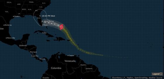
Dorian cracked the threshold to become a major hurricane Friday when its winds reached 115 miles per hour and it could grow stronger still as it moves over warm Atlantic waters that provide fuel for summer storms.
“Everything that is happening today is frightening from the perspective of a professional,” Truchelut said.
While the official forecast from the hurricane center calls for Dorian’s winds to top out as a Category 4 storm with winds of 140 miles per hour -- capable of tearing walls off houses -- forecasters fear it could grow even more.
“I am very concerned with what we are going to see,” Truchelut said.
On Friday, the National Weather Service said it was launching extra weather balloons and scraping every extra piece of information it can grab to try to figure out what the weather patterns across North America and the Atlantic will be early next week. That evidence may show whether Dorian heads into Florida or just skirts the coastline.
The storm is holding true to its pattern of defying forecasts.
To contact the reporter on this story: Brian K. Sullivan in Boston at bsullivan10@bloomberg.net
To contact the editors responsible for this story: Tina Davis at tinadavis@bloomberg.net, Patrick McKiernan
©2019 Bloomberg L.P.