Humberto Expected to Turn Away From U.S. After Strike in Bahamas
Storm to Scrape Florida Coast as It Strengthens, Turns Seaward
(Bloomberg) -- The Bahamas are enduring another day of heavy rain and gusting winds as Tropical Storm Humberto moves through the chain, parts of which were devastated when Hurricane Dorian killed scores of people and drove many more from their homes early this month.
The new storm’s threat to the U.S. has diminished.
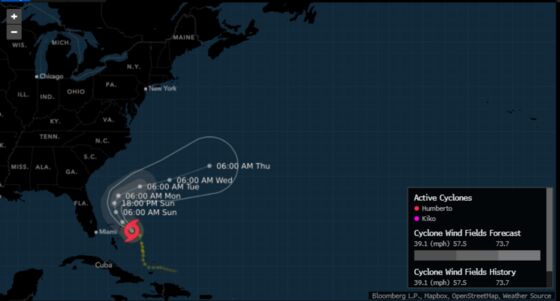
Humberto formed Friday from a cluster of thunderstorms and showers that had been raining down on the Bahamas for several days. The storm, with 40 mile (64 kilometer) per hour sustained winds, was drifting northwest through the chain near Great Abaco Island, the U.S. National Hurricane Center said.
“Humberto will likely bring tropical-storm-force winds and heavy rainfall to portions of the northwestern Bahamas” on Saturday, Jack Beven, a senior hurricane specialist at the center, wrote in a forecast analysis. “A significant storm surge is not expected in the northwestern Bahamas from this system.”
Storm surges washed over several islands in the chain during Dorian, causing much of the destruction from the Category 5 monster. At least 50 people are confirmed dead and the toll may rise as rescue crews sift through the rubble. Dorian struck with 185 mph winds and lingered over the islands for two days.
In a nation where 80% of the land is less than 32 feet (10 meters) above sea level, people were confronted with “20 feet of ocean in their backyard,” Duane Sands, health minister for the Bahamas, said on Wednesday. Storm surges typically kill about half of all those who perish in hurricanes.
The rain and gusty winds from Humberto could knock down more trees and power lines in areas hit by Dorian, said Brett Rathbun, a meteorologist at AccuWeather Inc. in State College, Pennsylvania. The biggest issue for most of the U.S. will be rough surf, he said.
“It is a much different monster than Dorian, which is fortunate,” Rathbun said.
Tropical storm watches for Florida’s east coast were dropped on Friday as forecasters became more confident that Humberto would turn into the Atlantic as it strengthened into a hurricane. This new track, though, raises the potential the storm will strike or come close to Bermuda by Thursday.
Humberto is the eighth storm named in the six-month Atlantic season, which ends Nov. 30. Currently the basin is at peak activity, and forecasters are watching four other areas that could develop into tropical storms over the next five days. In an average year, which produces 12 storms, the eighth appears around Sept. 24.
One system in the eastern Gulf of Mexico has a 20% chance of bringing a storm toward the Texas coast and through offshore energy platforms in five days.
--With assistance from Sharon Cho and Bill Lehane.
To contact the reporter on this story: Brian K. Sullivan in Boston at bsullivan10@bloomberg.net
To contact the editors responsible for this story: Tina Davis at tinadavis@bloomberg.net, Ros Krasny, Steve Geimann
©2019 Bloomberg L.P.